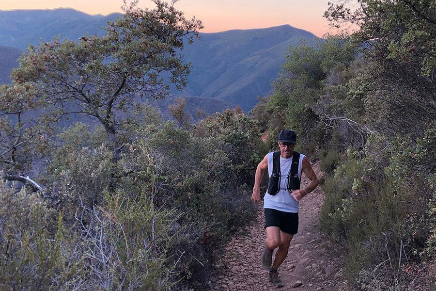
By Paul Sinclair. Located in the heart of the Cleveland National Forest in the Saddleback Mountain Range, Holy Jim is a gem of a trail.

Rewarding views as we work our way up Holy Jim
Back in 2013 I signed up for the Chimera 100 mile race, having spent my entire life in SoCal & never having heard of the Cleveland National Forest. This race traces its way through a good portion of these mountains, including Holy Jim, however, maybe it was the thick fog and rain, or maybe it was the pain of running 100 miles, but after that race I forgot about this area until getting reintroduced in 2017. My second introduction opened my eyes to this incredible mountain range and it became part of my weekly rotation.
So, I was pretty stoked when my buddy Floris called and asked if I would like to go for a run and show him around. Of course the natural choice to spotlight these mountains has to be the Holy Jim Trail.
Holy Jim Strava Maps and Elevation
Of the many trails in the Cleveland National Forest, Holly Jim is one of closest to most living in Orange County, however, it’s not the easiest to access.
From Trabuco Cyn Rd (paved), it’s 4.5 miles in on the maintained but unpaved Trabuco Creek Rd. I have no problem taking my Mini to the trailhead, but it’s rough and slow. The trailhead is well marked with ample parking, a couple of picnic tables & a porta potty or two.
Mountain Lion Encounters at Holly Jim
After a brief mountain lion scare while getting ready at the trailhead (it was still dark so we couldn’t see what was making all the noise) we set off for Santiago Peak. Fortunately it was a skunk that paid us no attention.
If I’m honest, I don’t often run alone in this area anymore as it can be very remote (especially mid-week) and the more time I spend in these mountains the more uneasy I feel about mountain lions.
I have 2 friends that have run into mountain lions in more or less the same area descending lower Holy Jim.
Just a few months back my buddy Gus ran Holly Jim solo. At approximately 10:30am with only 1.5 miles to go, he came upon a medium Mountain Lion blocking the trail only 20 feet in front of him. Gus grabbed his knife and stood his ground. A few seconds later a small cub darted across the trail followed by what looked like big mama lion, finally, the first lion took off after cub & mama. I hate to think how this might have went if Gus had been only 5 seconds farther down the trail.
There was also a report of a mountain on Horsethief during the Los Pinos 50k last September (Horstheif is only 2.5 miles from the Holly Jim trailhead).

Setting off early in an attempt to beat the heat
The trails starts off with a short stretch on a dirt road to the last house in the area, there you’ll cross a little creek as the trail turns to beautiful single track.

Flo in the zone somewhere on Lower Holly Jim
From the car it’s a runnable 5.2 miles with 2,400’ gain up Lower Holy Jim to Main Divide.
 The final little climb to Main Divide is the only steep part of Lower Holy Jim
Lower Holy Jim to Upper Holy Jim Trail
At Main Divide you can go left and take Main Divide fire road 3 miles to Santiago Peak. Another option is to head right on Main Divide for 0.5 miles and then head left up the fairly steep Upper Holy Jim Trail; Upper Holly Jim is only 1 mile, but it’s more of a hike than a run. At the top of Upper Holly Jim you will reconnect with Main Divide for the final 1.5 mile ascent to the summit.
The final 3 miles from Lower Holly Jim to the summit gains 2,200’ and is exposed, so it can be very hot. I’ve also run the last couple of miles in the snow so be aware of potential severe weather conditions on this trail.

Flo at the top of Upper Holly Jim with Santiago Peak in the background.

If you don’t have a big smile on your face when to reach the summit you did something wrong.
Views from the summit of Santiago Peak
On a clear day the views from the summit can be pretty amazing with Catalina Island to the West and Mt Baldy, San Gorgonio and San Jacinto to the East.
From here it’s an quick 8 quad-busting miles down to the car. Total round trip mileage is 16.5 miles with 4,200’ gain.
Bring plenty of water as there’s none on the trail; I had 32oz & ran out with a mile to go.
From the Holy Jim trailhead you can access several other trails, including Trabuco, Horsethief and one of my other favorites, Yeager / Bell Ridge.
What makes Holy Jim so special is it’s always well maintained and its easy access to Santiago.
Holy Fires in Cleveland National Forest

Photo: @orangecountyoutdoors
Sadly, as I write this the Holy Fire has claimed 23,000 acres, several homes and no doubt a staggering number of wildlife. It is still burning strong with the time of writing at 72% contained. Several of the trails have been damaged, including parts of Holy Jim to Santiago Peak.
Before you plan to run this trail, check out The Incident Info System website and give the ranger station a call for the latest trail status. We hope to be running these trails soon again!


