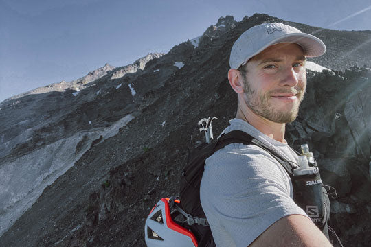

There’s something powerful about running volcanos. Whether it’s up, down or around them, it’s humbling how small you feel, just a tiny bag of bones plodding along on a geographical formation that’s shaped the entire planet for millions of years before you showed up, sipping your Starbucks and debating which gel is superior. These monsters can change the landscape, the weather, the entire planet, and they can also change your life if you use them correctly.
Here in the Pacific Northwest, they shape the skyline almost everywhere you look, perhaps no more so, than in Bend, Oregon, the heart and soul of volcano running in the US. As a PATH athlete, it’s been my mission to put our slogan of “mountain tested”, to the test.

South Sister
12 miles and ~5,000ft of vertical gain round trip, South is generally the most straight forward of the climbs here. Starting at 6,000ft above sea level, my Killam PX pants are clutch for the cool, pre dawn starts. You”ll spend the first 1.75 miles in steep woods before enjoying a runnable approach, and then the work begins, navigating a fairly challenging but clearly marked trail to the summit. Views here are tough to beat, bring some poles, run the down and call yourself a local once you’re done.
Middle sister
14.75 miles and ~4,700ft of vertical gain, the approach to Middle is the same as North (outlined below). You’ll cross the Hayden Glacier before taking the ridge line, following a fairly well established foot path to the top. Things are exposed and get hot on this route, my saving grace this summer was packing snow into my Muir Cap from the glacier, it surprisingly insulates the snow so it doesn’t melt quickly and keeps you cool on the mile-ish climb to the summit.

North sister
15 miles and ~5,200ft of vertical gain, North is the sketchiest of the sisters. Starting at Pole Creek Trail Head, you’ll cruise through a burn zone for 4.5 miles before jumping on a climbers trail, winding you up to the base of the mountain. There’s flowing streams all summer from the glaciers and the Unita AD SS shirt helps keep things cool on hot days in the exposed terrain. You’ll take the ridge line and scramble up to the terrible traverse and bowling alley, which come in at somewhere between class 3 and class 4 scrambling. The mountain is notoriously crumbly, without much room for error. “It’s not too bad overall, but if you mess up it might kill you”.
Mt. Bachelor
6.5 miles and ~2,700ft of vert, Bachelor (which is the main ski hub in winter) makes for a quick, easy up and down. Park on the road by the Sunrise lift (or .25 mile down the road at Tumalo Mountain) and follow the winding road up past the lifts for the first 1 mile. Connect into the summit trail and cruise the easy but rocky switch backs until you pop out at the summit by the Summit lift. Early in the season when there’s snow present, the glissade down makes the descent much quicker!
Mt. Washington
11 miles and ~3,200ft of vertical gain, Washington starts slow but finishes with a BANG. You’ll wind 3 miles of easy running on the PCT before hooking off on a climbers trail for roughly a mile to gain the ridge line. A fairly comfortable scramble on the spine will lead you to the summit block, which is class 4-class 5 scrambling. You can do it without ropes if you know what you’re doing and enjoy exposure, but this isn’t a section to play on. Rope up if you’re not good with sketchy climbing. The rocks not great and the wasps can be bad in the summer, I rock my Pyrenees T19 long sleeve shirt to keep the bugs off without overheating.

Three Fingered Jack
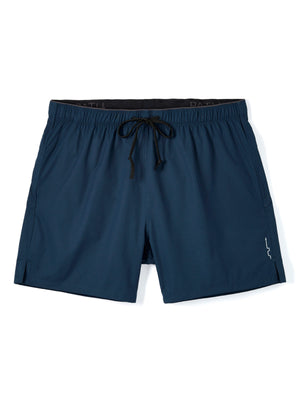
12.4 miles and ~3,000ft of vertical feet, TFJ starts with a gorgeous 4ish mile section on the PCT. You’ll hook a right on a climbers trail, heading up a steep skree field until you gain the ridge line. This whole mountain is jagged and crumbly, the Cascade T-shirt and Sykes PX Shorts provide good protection from the rock while keeping me cool in the exposed terrain. Navigate the ridge line until you get to “the crawl” and either take advantage of some protection and rope up, or don’t look down and inch across the 1,000ft+ of vertical drop and then scramble up the chimney. At the top, you’ll encounter a knife edge ridge that requires extreme caution in traversing to reach the true summit. This mountains killed people, so don’t take it lightly.
Mt. Jefferson
14.25 miles and ~7,200ft of gain, this is the big boy of the CO volcanos! Although the standard route checks in at over 20 miles, you can reduce this by taking the South West Ridge. You’ll cruise several easy miles from Pamelia Lake before cutting into the PCT. It’s all easy going until it’s not, and you’ll hook a left up a near vertical 1 mile section of the most horrendous bushwhacking you can imagine. After you’ve spilled blood in the bush, you’ll gain the alpine and lose the tree line, connecting in with the primary ridge route until you reach the Red Saddle. Overall the rock is decent albeit steep. At the saddle, you’ll cross the omnipresent snowfield, typically with an ice axe and crampons (many people rope in) and then finish with a class 3/4 scramble up the summit pinnacle (there’s two, make sure you hit the true summit and not the false!). The views into Washington are gorgeous and you’ll have bagged one of the lesser done major peaks in the cascades.

Ditch the roads and explore some of the more epic terrain we’ve got here in the PNW! Be safe out there.
It’s important to remember everyone has different levels of ability and comfort with exposure, glacial travel and rock climbing. Stay within your limits, always wear a helmet when there is potential for rockfall and rope up when you need to!
To learn more about Kyle, check out his KREW page / IG / Strava.